How GPS Knows Exactly Where You Are
By Joel Burns on June 25, 2026
Whether you’re navigating to a new restaurant, tracking a morning run, or sharing your location with a friend, GPS makes it possible for your device to know where you are with remarkable accuracy. Most of us use GPS every day without giving it much thought, but the technology behind it is surprisingly fascinating.
What seems like a simple blue dot on a map is actually the result of advanced mathematics, atomic clocks, and a network of satellites orbiting thousands of miles above Earth. Here’s how GPS figures out your location in just a few seconds.
What GPS actually is
GPS stands for Global Positioning System. It is a satellite-based navigation system originally developed by the U.S. military and later made available for civilian use worldwide.
The system consists of more than 30 satellites continuously orbiting Earth. These satellites are carefully positioned so that several of them are visible from almost any location on the planet at any given time.
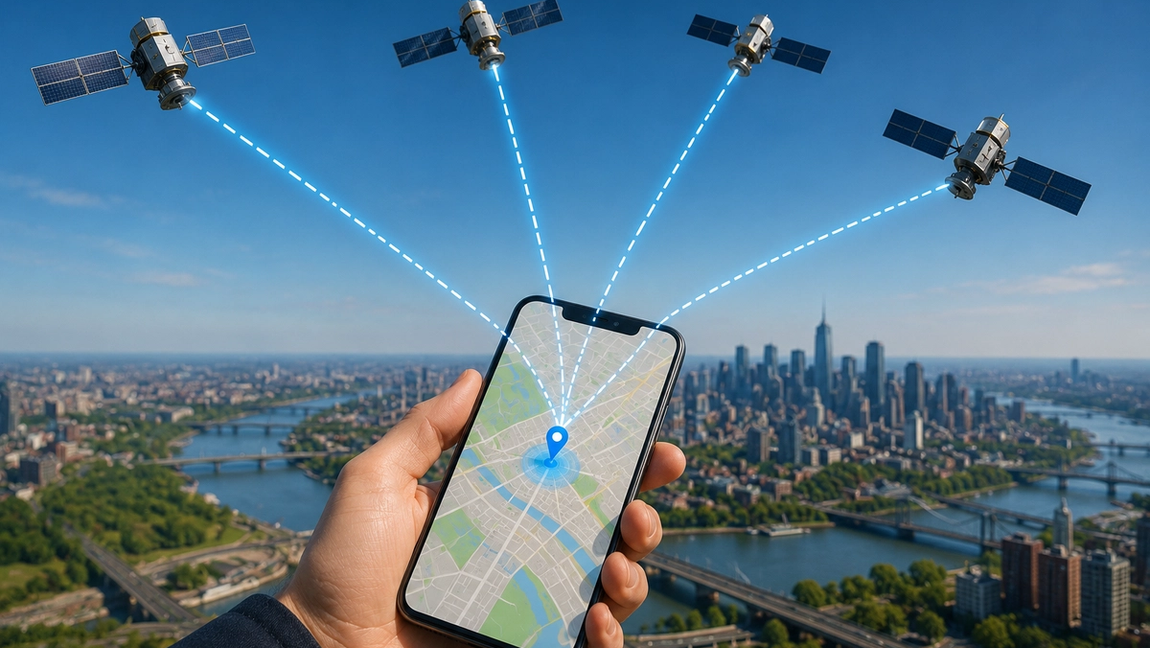
Each satellite constantly broadcasts information about its position and the exact time the signal was sent. Your smartphone, car navigation system, or smartwatch listens for these signals and uses them to determine where it is.
The important thing to understand is that GPS satellites don’t know where you are. Instead, your device calculates its own location by measuring signals received from the satellites.
Measuring distance with time
GPS works because radio signals travel at the speed of light.
When a satellite sends a signal, it includes a timestamp showing exactly when the transmission occurred. When your phone receives that signal, it compares the transmission time with the current time.
Even though the difference is tiny—often just fractions of a second—it allows your device to calculate how far away the satellite is.
For example, if a signal takes 0.07 seconds to reach your phone, the device can estimate the distance between itself and the satellite based on the speed at which the signal traveled.
This process happens simultaneously with multiple satellites, creating several distance measurements that can be used to pinpoint your location.
Why one satellite isn’t enough
Knowing your distance from a single satellite doesn’t reveal your exact position.
If you know you’re 20,000 kilometers from a satellite, you could be anywhere on an enormous sphere surrounding that satellite. A second satellite narrows the possibilities, but there are still multiple potential locations.
This is where a technique called trilateration comes in.
By measuring the distance to at least three satellites, your device can narrow down its position to a specific point on Earth’s surface. In practice, GPS receivers typically use four or more satellites to improve accuracy and account for timing differences.
The more satellites your device can see, the more precise the calculation becomes.
Why GPS is so accurate
One of the most impressive aspects of GPS is its accuracy.
GPS satellites carry atomic clocks, which are among the most precise timekeeping devices ever created. Because GPS relies heavily on timing, even an error of a millionth of a second could result in a significant location error.
Modern smartphones can often determine location within a few meters under good conditions. Additional technologies such as Wi-Fi positioning, cellular tower data, and advanced software help improve accuracy even further.
Some specialized GPS systems used in surveying, aviation, and scientific research can achieve accuracy measured in centimeters.
What can interfere with GPS signals?
Although GPS is incredibly reliable, it isn’t perfect.
Tall buildings, mountains, tunnels, and dense forests can block or reflect satellite signals. This is why navigation apps sometimes become less accurate in crowded city centers or when driving through tunnels.
Weather usually has only a minor effect on GPS, but atmospheric conditions can occasionally cause small inaccuracies.
Indoor environments can also make GPS less effective because roofs and walls weaken the signals before they reach your device.
To compensate, smartphones often combine GPS with other location technologies, allowing them to continue estimating your position even when satellite signals are limited.
The future of location technology
GPS has become so common that it’s easy to forget how revolutionary it is. Just a few decades ago, determining your precise location often required maps, compasses, landmarks, or specialized navigation equipment.
Today, a device that fits in your pocket can calculate your position almost anywhere on Earth within seconds.
As satellite technology continues to improve, location services are becoming even more accurate and reliable. Future systems may enable better navigation for autonomous vehicles, more precise emergency response services, and new forms of augmented reality that depend on exact positioning.
The next time you open a maps app and instantly see your location, remember what’s happening behind the scenes. Your device is communicating with satellites traveling thousands of miles above Earth, using incredibly precise timing and complex calculations to answer one simple question: “Where am I?”